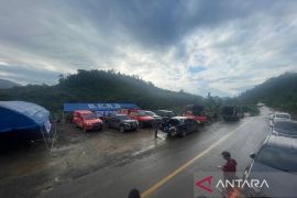
Batulicin, S Kalimantan (ANTARA) - The Tanah Bumbu Disaster Mitigation Agency (BPBD) is mapping areas prone to floods, landslides, and whirlwinds.
Head of the agency Eryanto Rais through Head of Disaster Preparedness and Prevention Abdul Rahim here on Friday (Jan 10, 2020) said, when rainy season there are several areas prone to flood, including the sub-districts of Kusan Hulu, Angsana, and Satui.
"While landslides ofter occur in the subdistricts of Kusan Hulu and Mentewe," he said.
The local government, he said, currently held a coordination meeting related to anticipation of floods, landslides, tornadoes, and tidal waves with the regent and related agencies. The meeting was also to map disaster prone areas.
Related news: S Kalimantan should watch out flood, landslide, waves
Regent H. Sudian Noor remarked, related to Governor H Sahbirin Noor letter dated Oct 15, 2019 regarding anticipation of floods, landslides, whirlwinds, and tidal waves in South Kalimantan, he as regional head has instructed all parties and agencies (SKPD) to immediately follow up and coordinating with regard to handling disaster as early as possible.
"We all must be vigilant and be prepared for natural disaster that can happen at any time," he pointed out.
Alertness and preparedness in very important, because of Tanah Bumbu location and geological condition have a level of prone to natural disaster.
In mapping disaster prone areas, BPBD established posts and placed some personnel in each sub-district, so they can work quickly, precisely, efficiently, and effectively.
"BMKG South Kalimantan has forcasted that extreme weather to occur on January 10-15, so we have to be on alert to disaster," the regent concluded.
Related news: Secretary of Banjar calls for improving disaster preparedness
Related news: Kotabaru Naval Base increases SAR skill in disaster mitigation
Related news: HSS Regent issues circular to anticipate disasters
Related news: Hundreds of students in HSU prepared to deal with disasters


