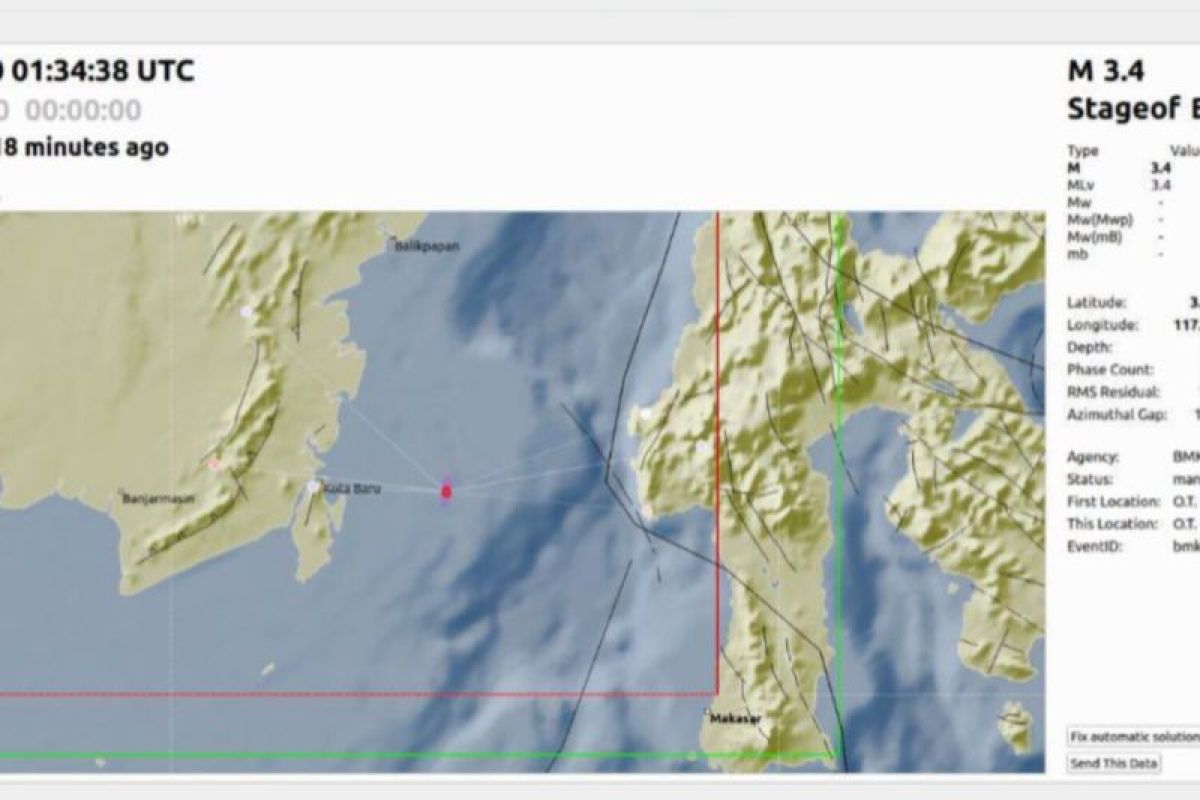
The Meteorology, Climatology, and Geophysics Agency (BMKG) has detected A magnitude 3.3 earthquake rattled the district of Kotabaru, South Kalimantan.
Based on the information from the BMKG's Information system, the quake occurred in the Kotabaru waters at 09.34 WITA (Central Indonesia Time).
The epicenter was located at 3.34 South Latitude-117.26 East Longitude or about 113 kilometers east of Kotabaru with a depth of 10 kilometers.
So far, there has been no report from the public or confirmation about any damage or impact that caused by the quake in Kotabaru and its surroundings.
A quake of the same magnitude was reported by BMKG on Thursday (March 28, 2024) had rattled the district of Kotabaru.
It was centered on the land about 68 kilometers southeast of Tanah Bumbu at a depth of 6 kilometers.
Related news: A magnitude 3.3 quake rattles South Kalimantan's Kotabaru
Related news: Residents do not feel a jolt of 3.3M quake: Kotabaru BPBD
Related news: South Kalimantan BPBD educates students about quake disaster mitigation
COPYRIGHT © ANTARA News Kalimantan Selatan 2024
Based on the information from the BMKG's Information system, the quake occurred in the Kotabaru waters at 09.34 WITA (Central Indonesia Time).
The epicenter was located at 3.34 South Latitude-117.26 East Longitude or about 113 kilometers east of Kotabaru with a depth of 10 kilometers.
So far, there has been no report from the public or confirmation about any damage or impact that caused by the quake in Kotabaru and its surroundings.
A quake of the same magnitude was reported by BMKG on Thursday (March 28, 2024) had rattled the district of Kotabaru.
It was centered on the land about 68 kilometers southeast of Tanah Bumbu at a depth of 6 kilometers.
Related news: A magnitude 3.3 quake rattles South Kalimantan's Kotabaru
Related news: Residents do not feel a jolt of 3.3M quake: Kotabaru BPBD
Related news: South Kalimantan BPBD educates students about quake disaster mitigation
Editor : Mahdani
COPYRIGHT © ANTARA News Kalimantan Selatan 2024

